

REDMOND, OR -- The "atmospheric river" drenching the Valley over the last few days is also responsible for Central Oregon's unseasonably soggy forecast. Ed Townsend, meteorologist for the National Weather Service in Pendleton, says Redmond recorded 1.83" of rain in the first 13 days of this month, making this one of the top 10 wettest Junes at the airport. "There’s only been two days when they haven’t recorded at least a trace of precip," Townsend tells KBND News, "So, this is a pretty wet start to the month, when usually you’re looking at maybe 2/3” for normal precip in June and we’re already well in excess of that."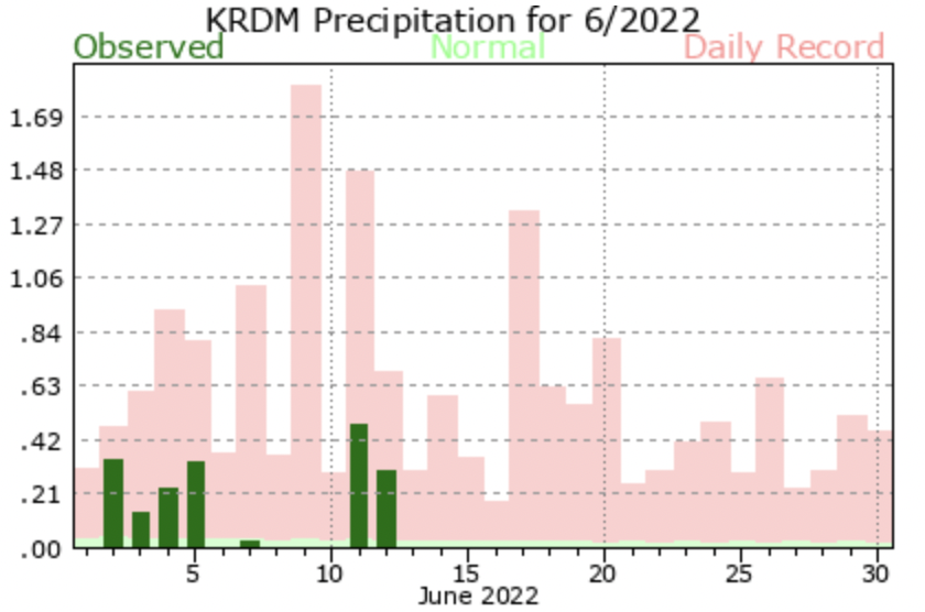
He says the atmospheric river covered Oregon and parts of Washington and Idaho for several days. Townsend says that length of time is unusual, especially in June, "It’s pretty atypical to see one this time of the year. Usually, when we think of these giant plumes of moisture coming into the Pacific Northwest, we’re thinking winter and spring."

