PORTLAND, OR -- An interactive map showing the wildfire risk of every property in Oregon is now available for the public. The Governor’s Wildfire Programs Director Doug Grafe says it’s a transition for how the state thinks about wildfire, "We’re not only simply going to react to wildfires in Oregon, but we’re going to take a proactive stance to mitigate and prevent the catastrophic risk of wildfire across Oregon, with proactive programs and greater understanding of our fire risk."
The Oregon Wildfire Risk Explorer is the product of SB 762, passed in 2021, and was developed by the Oregon Department of Forestry and Oregon State University. ODF Fire Protection Chief Mike Shaw says the map identifies the wildland-urban interface and assigns wildfire risk at the property level, "And this is important because it allows every Oregon resident an opportunity to understand the risk of wildfire where they live and to mitigate against those risks." There are five risk levels: No Risk, Low, Moderate, High and Extreme. 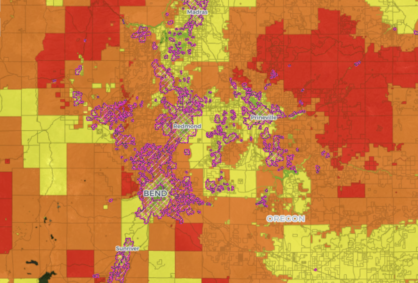
Allison Green, with the State Fire Marshal's Office, says SB 762 also assigns tasks to her agency, "The big one is to establish a minimum defensible space code, then we’ll apply to those lands that are in the mapped wildland-urban interface and meet the criteria of risk, either high or extreme." She says those rules are still in development, and eventually grants will be available to help property owners comply.
The map is available at ODF’s website or click HERE. You can also search online for “Oregon Explorer.”