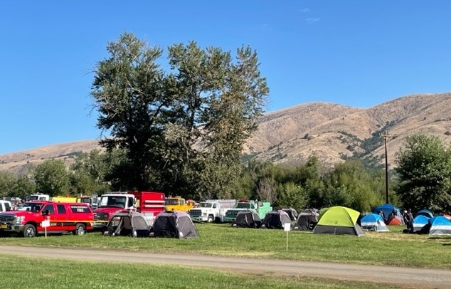
REDMOND, OR -- The Miller Road Fire, burning 13 miles southwest of Maupin is now estimated at 10,500 acres, with no containment. As of Thursday morning, evacuation orders remain in place, as air tankers and ground crews converge on Juniper Flat in Wasco County. [Pictured: Miller Road Fire camp]
Carol Connolly, with the Northwest Coordination Center, says the Miller Road Fire is growing fast, "They have still been receiving some high winds and that fire has been wind-driven. It’s burning in heavy dry fuels, including grass, shrubs and juniper. The crews are currently evaluating some of the snags along the perimeter and along Highway 216. However, the primary focus is protecting structures and attacking the east and south flanks." She tells KBND News, "It’s a mixed landscape with a lot of ranches and farms, and there are primary structures, cabins, outbuildings in that area. So, there has been structural protection put in place in and around those buildings. However, I have not received a report if we have had any structures lost at this time."
FEMA has authorized federal funds to help pay for fighting the Miller Road Fire. The agency says the fire threatens to "cause such destruction it would constitute a major disaster." It threatens homes in and around Pine Grove, Tygh Valley and Maupin, as well as a major power transmission line and three communications towers.
Oregon received 5,000 lightning strikes in a 48-hour period, sparking more than a hundred small fires, including several in the Deschutes National Forest. About 13 miles southeast of La Pine, the Green Butte Fire is mapped at just 23 acres but is 0% contained. Connolly says, "Because we had the air support in the region, they assisted the ground firefighters and the ground engines working that fire. So, we’re very fortunate that we have had a lot of air tankers in Oregon and Washington."
The Cedar Creek Fire was discovered late Monday in the Willamette National Forest, 17 miles east of Oakridge. Connolly says it was first reported Monday and quickly grew to around 500 acres, "Local crews had a really hard time getting to the fire. It’s very steep, rugged terrain with minimum roads and minimum access. Aviation resources have been flying the fire." She adds, "Aviation resources have been working the fire. However, ground crews have not been able to get in there because there are no safety zones or escape routes for our firefighters." An incident management team takes over command of the fire Thursday, and there are emergency closures in place.
In the Malheur National Forest, the Beech Creek Fire is now 15% contained, at 248 acres. Highway 395 is open with a pilot car from milepost 103 to milepost 106.5, north of John Day. But, drivers should expects delays and heavy fire traffic.


