
BEND, OR -- Despite recent storms, Oregon’s snowpack is well below normal for this time of year. A series of four atmospheric rivers moved through the state in late November and early December. "This was a period where we have a lot of precipitation accumulating, but at least in some regions, not a lot of snowpack," says Associate State Climatologist Nick Siler. He says temperatures during that same time were about four degrees warmer than normal.
Siler says those warmer temperatures are due to the El Niño weather pattern, "We see pretty much across the board, with the exception of a couple of basins in SW Idaho and SE Oregon, we see significantly lower percentiles of snowpack than we do of precipitation."
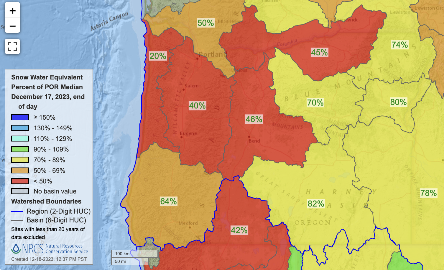
Overall, Oregon's snowpack is between 20% and 80% of what's considered normal for this time of year. As of Monday, the Deschutes Basin is 46% of average. "I would like to emphasize, it’s still early in the accumulation season, so there’s plenty of time to recover from this snowpack deficit," says Siler, "However, if we look at the seasonal forecast from the Climate Prediction Center, we see that above average temperatures are likely across the Pacific Northwest, for December through February." He adds, "This suggests an elevated risk of snow drought, meaning low snow-water equivalent values, independent of what happens with precipitation." That means, "Even if precipitation is close to normal, especially at the lower elevation sites where snow tends to fall closer to the freezing point, we’re likely to see lower than average snowpack accumulation."
And that could prove problematic for summer irrigators and recreators who count on the snowpack to melt off and slowly replenish Oregon reservoirs.